The elevated aqueduct walk
45–90 min
Time for the visitor route, views and interpretation at the entrance, at an unhurried walking pace.
Historic aqueduct & elevated walk · Campolide & Alcântara valley
Aqueduto das Águas Livres
Walk high above the Alcântara valley on the structure that brought fresh water to the city.
At a glance
45–90 min
Time for the visitor route, views and interpretation at the entrance, at an unhurried walking pace.
Photographs


What to see
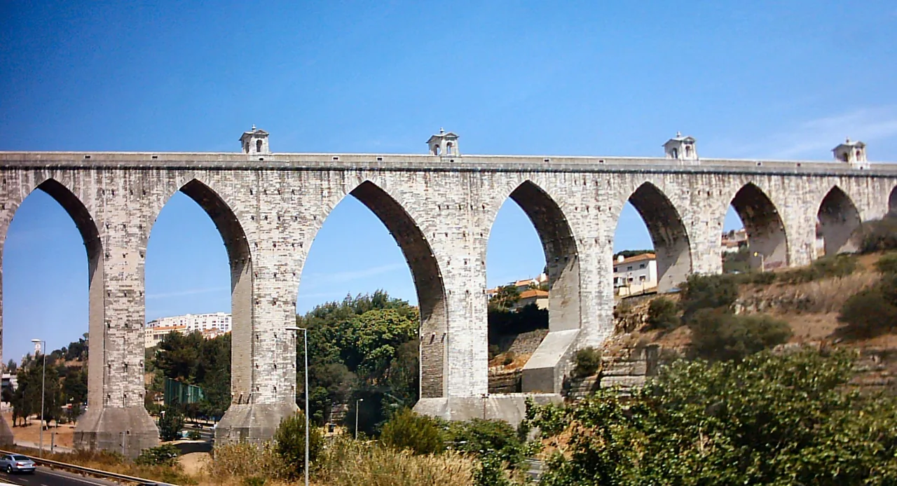
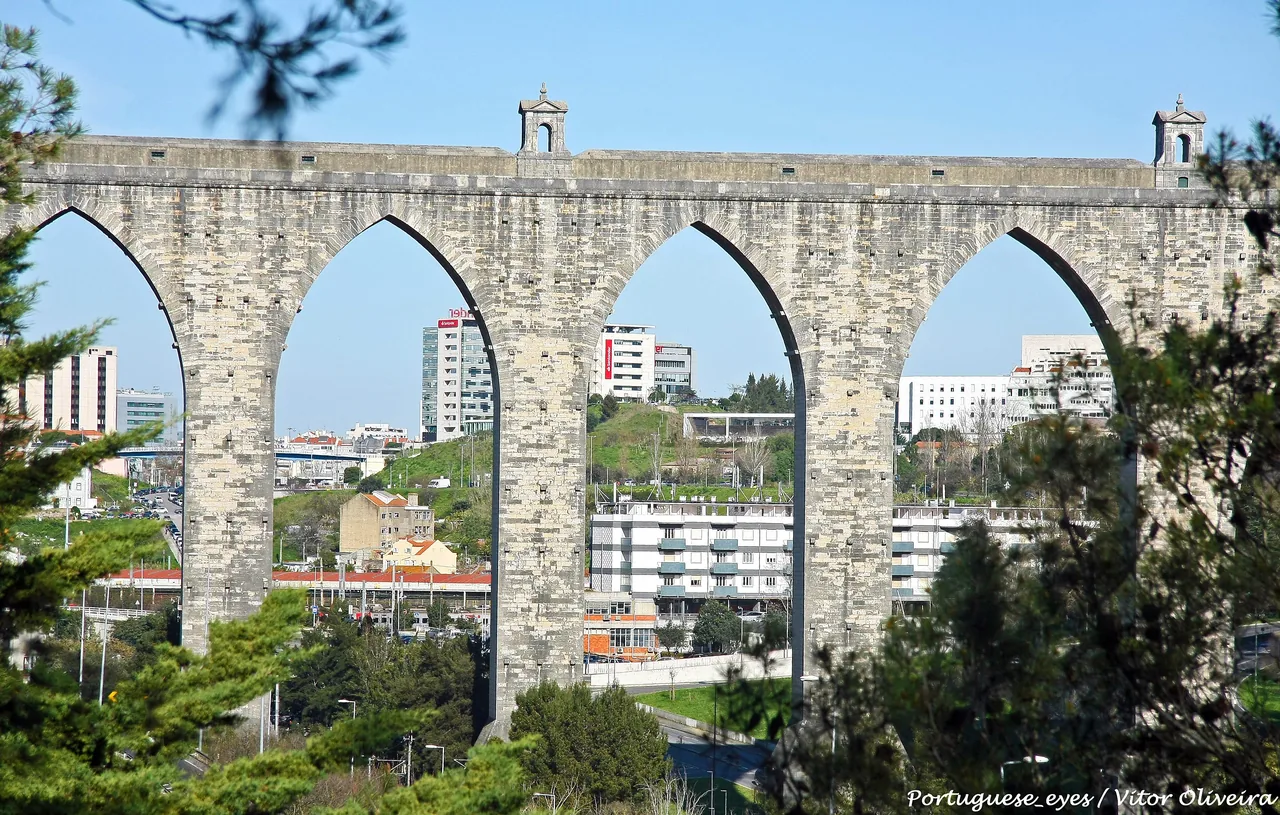
Seen from below, the Águas Livres Aqueduct is a line of enormous stone arches crossing the valley. Walking along it gives a quite different impression. The masonry is suddenly close enough to examine, while roofs, roads and railway lines lie below. It is an unusually direct way to experience a major piece of eighteenth-century engineering.
The appeal is the walk itself: the height, the long view beside the water channel and the city spreading across the valley. Seeing the masonry at close quarters makes the achievement of its builders easier to grasp. Walk slowly enough to notice how the structure works, then look out at the neighbourhoods that have grown around it.
Architecture enthusiasts, walkers and anyone curious about how cities obtain their water are likely to enjoy it. It is a more specialised choice than a central monument, and the elevated route will not appeal to everyone. If heights make you uncomfortable, consider whether admiring the arches from ground level would suit you better.
Look closer
Look along the line of the conduit before focusing on the panorama. The repeated masonry and narrowing perspective make the aqueduct’s length easier to appreciate. Walk at a comfortable pace and pause where there is room for others to pass. The return journey can reveal details you overlooked on the way out.
The valley crossing extends for about 941 metres over 35 arches. Its tallest arch rises roughly 65 metres. Those figures mean more once you are beside the structure, but the full shape is best appreciated from ground level. If you have time, include a separate view from below to understand what supports the route.
The aqueduct was part of a much larger supply network, bringing water from springs north-west of the city. Think about the practical problem as you walk: water had to keep moving across uneven ground without the route simply following every rise and fall. The valley crossing makes that engineering challenge wonderfully clear.
The view includes ordinary neighbourhoods and transport infrastructure as well as distant landmarks. That is part of the appeal. Look at how later roads and railway lines occupy the valley around an older system of movement. The aqueduct offers a perspective on urban life that differs from the familiar riverfront viewpoints.
The visitor perspective
The height and the scale of the engineering are what visitors tend to remember. Accounts of the walk describe unusual city views and the pleasure of exploring a structure that many people only glimpse from a train or road. For those interested in architecture, being able to get onto the aqueduct is the main attraction.
Finding the entrance can be less straightforward than spotting the monument. Some reviewers only saw it from a distance, while others describe initially heading to the wrong place. The distinction matters: an impressive view of the arches and the visitor crossing are two different experiences.
Weather also features in the accounts. Wind or rain need not spoil the outing, but they can make an exposed walk less comfortable. Choose a suitable day, navigate to the gate and come expecting an architectural walk, rather than a museum with numerous separate rooms to explore.
Visitor feedback reviewed:
The story
Work began in 1731 under João V to address the need for a more dependable water supply. The project drew on springs around Belas and developed into a network of channels, reservoirs and fountains. Taxes on everyday goods helped fund it, making this an immense public undertaking as well as a royal project.
The structure survived the earthquake of 1755. Its main route and later branches extended far beyond the arches most visitors recognise. The dramatic valley crossing was one element in a system whose purpose was practical: moving water into the city and distributing it where people could collect it.
The aqueduct ceased supplying water for human consumption in the twentieth century. Preserved as part of EPAL’s Museu da Água, it now allows visitors to examine that earlier infrastructure at close quarters. The museum also cares for other water-related sites, which should be planned as separate visits rather than assumed to form one continuous public route.
Planning your visit
For current opening hours and ticket details, visit the official website.
Official visitor information ↗The area
For the visitor crossing, head to the Museu da Água entrance at Calçada da Quintinha, 6, in Campolide. The aqueduct is visible over a wide area, so navigating towards the arches alone can leave you far from the gate. The Mãe d’Água reservoir at Amoreiras is a separate visitor site, not the entrance to this walk.
This is a route through the city. The map marks a reference point to help you find your bearings.
 Open map
Questions about this place
The structure you visit dates from the eighteenth century, although its builders drew on a much older engineering tradition. Construction began in 1731.
Use the Museu da Água visitor entrance at Calçada da Quintinha, 6, in Campolide. Other stretches of the aqueduct and the reservoir at Amoreiras are not the same entrance.
The route is elevated above the valley. Its appeal depends partly on that position, so it may not suit someone uncomfortable at height. Viewing the arches from below offers a different way to appreciate the structure.
No. The reservoir is a separate site within the water museum’s wider network. This guide covers the visitor walk on the monumental valley crossing.
More of Lisbon
Visitar editorial team
Based on official visitor information, historical and collection records, and a sample of individual traveller reviews.
Visit times are estimates. The guide is based on published sources; it does not include an on-site inspection. Photographs come from credited sources and may show earlier displays or arrangements.
Content reviewed: · Visitar.com
Image resized for display; full source and licence linked.